Monday, April 29, 2013

Agility required to tackle Moat Mountain trail

We went hiking in the White Mountains of New Hampshire the other day. I plan to write a more full account of the trip for my next Kid Tracks column but I know there are some things that will never make it into that 18" column.

For instance, we got off to a slow start due to me not having time to food shop so I had to pick up sandwiches for our mountain top lunch. I lamented the late start but c'est la vie with my schedule lately.

Then a woman at the trailhead locked her car keys in her car and asked us to borrow a phone to call for a rescue. This prompted Shannon and my 15-year-old to discuss yoga moves – and then try them – while we waited for the woman to make her call(s).

 You can see the woman making her call behind Shannon.

We have hiked to Diana's Baths many times and it is still a treat to see the waterfalls in the spring. But truth be told, you have to see – and hear – the falls to really appreciate the splendor.


Roundtrip to Diana's Baths is about a mile on fairly level terrain. It's a nice (young) family-friendly hike.

Despite many visits, this was the first time we'd planned to follow the Red Ridge Trail that snakes up the river to the Moat Mountain loop. I had read in the AMC White Mountain Guide that there would likely be at least one or two tough river crossings that might not be passable in the spring.

It turned out they were not as scary as anticipated but they still required some problem-solving skills and a bit more effort than usual.

The first was the typical walk across on logs. The logs didn't feel all that steady to the adults of the group so Shannon decided to head down the river to a large log she had to straddle and shimmy across. I didn't think the straddle thing looked all that fun so I found another way to cross. We each had our own style and we had a good laugh about it.


Then there was the next big crossing that did not offer stepping stones or logs. After walking up and down the river bank in each direction we determined the only way to get across was to walk through the water. There were no stepping stones above the water and it was only knee-deep. So we pulled off our socks and boots to walk across barefoot. The water was so incredibly cold that my 15-year-old said her feet felt like they were burning from the cold. Not so comfortable but it was a narrow crossing and we all did it without incident.


It's quite challenging to photograph "cold" but trust me, these red feet were dang cold after our river walk-across.

On the return trip across the bare footed crossing, my 15-year-old wore her wool socks to protect her feet from the cold water. It was a good thing I had an extra pair of socks for her to wear on the hike back to the car. I've learned extra socks are a must on mountain trail hiking.

Then there was the third crossing, which was the fastest moving water we encountered. There were stepping stones to jump but it required a not very direct route across with lots of jumping and a good balancing act for each of us.


Other than the river crossings (which really do require some agility so be ready for that if you visit this trail at this time of year), it was a fairly easy hike for the first couple of miles until the terrain started upward. Then the climb was all business and required serious stamina.

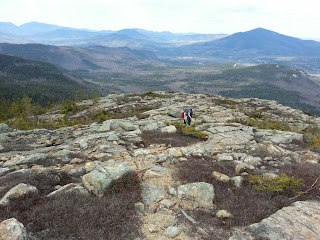
If you were out on the trail the day we were, you likely could have heard our exclamations that every time we hit a rock plateau, we saw another one before us.

 You can see the top of this pile and it really does look like the summit. But no, once reached the view would be another just like it.

After four plateaus I decided I was taking a break. Shannon and my 15-year-old climbed one more plateau and I believe they could be heard for miles with their "ugh! There's another one!" exclamations.

I was happy I took a snack break while they made that last discovery.

Despite the fact that we did not make it to the summit of the "unnamed peak" on the Red Ridge Trail portion of the Moat Mountain loop (had we continued after the unnamed peak we would have gone done a steep decline for a bit before climbing up to the summit of Moat Mountain), we felt accomplished. We covered approximately 9 miles total roundtrip and climbed about 1,900 feet. These were the highest numbers of our season so far (we are hoping to tackle Mt. Washington this year so we need to pay attention to our numbers to ensure we can really do that climb).

More important than those numbers however, was the fact that we had some good belly laughs and a memorable hike despite the fact we didn't summit any mountains.

But the consolation was that the view at the elevation we did climb really was awesome.


Here's a peak at our interactive map of the trip. The mileage is off (thanks to a wiggy android GPS app) but the terrain and photo placement is accurate.

Red Ridge Trail on Moat Mountain


My Kid Tracks column runs in print the second Sunday of every month in the Outdoors section of the Telegram. 

Sunday, April 14, 2013

Kid Tracks column: Burnt Meadow Mountain just right for a spring hike

Trying to plan a hike in the spring in Maine, particularly this year, is a real guessing game. Will there be snow? Or mud? Or will we get lucky with some dry conditions? My safest bet has to assume we'll be finding a combination of all three.

Because of the unpredictability of spring hiking conditions, my family tends to stick to trails we have visited previously. This ensures that we are familiar with the basics of the terrain (and knowledge of its trail blazes) to help make a more educated guess about our ability to handle the conditions if the trail is snow-covered.

We decided to visit a mountain trail we are very familiar with -- Burnt Meadow Mountain in Brownfield. Last summer we hiked to the summit for the first time (although we'd visited many times before summitting). The hike we took in July was hot and amazingly plentiful in the bug department. We decided after that hike it would be a good idea to visit again during the off-bug season.

On our drive to the mountain I told my passengers (my teenagers as well as our friend Shannon) that we might not make it to the summit of the mountain. We were going to play it safe because there was a steep, rocky climb during the last part of the North Peak Trail.

Luckily for us, the mild temperatures of the day and the recent rain had left little snow on our climb up the mountain. But getting down was another story because we decided to loop back down on the Twin Brook (yellow blaze) Trail to the Burnt Meadow (blue blaze) Trail. Our trouble with Twin Brook Trail was that it was still snow-covered. Shannon said it best when she used the analogy that this part of the hike was like running on sand.

We put a lot of effort into moving without getting very far with all the cautious stepping we did. I also feel that going down a mountain trail is actually harder than climbing up and this particular day confirmed that sentiment.

It was, however, good training for our leg muscles for our trip to Mt. Washington -- which we spotted (still heavily snow-covered) from this mountain -- and which we plan to tackle later this year.
I made a map of our hiking adventure with my EveryTrail app on my Android phone and there was a bit of a snafu with the GPS tracking. It did a weird zigzag track that ended up calculating more mileage than we actually covered.

I knew from our previous hike that this loop is 3.5 miles with an elevation gain of about 1,200 feet. But our most recent visit recorded over 10 miles. And I have to say that trek down the mountain, which took us twice as long as the climb up, had us commenting that it had in fact felt like we had gone that far (proving once again that numbers really can lie to suit your needs when you want them to).

With this first mountain hike of the spring under our belts, we are researching our next trek. The trick is deciding where to go based on conditions we can handle without any specialized gear. A coastal mountain hike in Camden has made the short list for our next adventure in hopes of a less snow-covered experience.

No matter which mountain you decide to hike this spring, be sure to talk to the kids ahead of time that plans may need to be changed on a moment's notice based on the trail conditions you find along the way.

Even with teenagers, I find a chat ahead of time saves a lot of "debate" about mom's decisions on the trail.

Despite the snow conditions and the early April date, we did run across several flying insects on the loop back down the trail. The bugs on this trail are amazingly hardy.
 
Hiking at this time of year can be a mixed blessing – it’s great to get out ahead of the bugs, 
but the trails often can be a challenging mix of mud, snow and dry terrain. 

The last part of the trail before the summit of North Peak Trail is a steep climb, 
but it was thankfully free of snow and ice on this day.

Burnt Meadow Mountain North Peak Loop


Staff Writer Wendy Almeida can be contacted at:
wea@mainetoday.com
Twitter & Instagram: wea1021

Originally published in the Maine Sunday Telegram April 14, 2013.

Friday, April 12, 2013

A lesson in Geocaching trackables

When doing some maintenance on one of our geocaches the kids ran across a "coin." We originally thought it was a Travel Bug, an item that travels from one geocache to another that is tracked online, but we were mistaken. It turns out there are all sorts of "trackables" to be found in a geocache. The one we found was actually a signature item.

The "Kayaking Loon" Path Tag we found was actually a signature item this particular geocacher leaves in the geocaches s/he finds.

Confused about the trackables in the geocaching game? I have a basic working knowledge of them but don't know the details of every kind, which was obvious upon me mistakenly identifying a Path Tag signature item for a Travel Bug.

When a geocacher finds a Travel Bug in a geocache they are supposed to look for the unique serial number on its tag and log it into the geocaching website's special Travel Bug page. This alerts the owner their Travel Bug was found. It is then the geocacher's job (because they picked up the Travel Bug) to move the Bug along to a new geocache.

A few years ago my kids' 4-H club launched a Travel Bug as part of a national 4-H program called CYFERnet and spent nearly a year tracking their little 4-H keychain (with special ID tag) online. Their Travel Bug connected with some wonderful geocachers and that little Bug made it to four different continents and traveled 21,985 miles that year. They won the CYFERnet contest and the kids could not have been happier.

 The 4-H Walker Travel Bug was simply a 4-H keychain with a special ID tag that was registered on Geocaching.com as a Travel Bug.

 
The kids' travel bug traveled 35,873.7 miles before it was marked missing. The bug's information page automatically plots all the locations it was found on this handy-dandy (and quite fascinating) map.

We have had other travel bugs that have jumped states, countries and continents but none traveled as far as that 4-H one did. And these days we haven't heard a peep from the location of most of them. But that's how things happen, eventually.

So when the kids found a coin with a serial number on it, of course we thought it was a Travel Bug and wanted to do the responsible thing and move it along to another geocache. But when I noticed the website to log the find of the traveler – www.pathtags.com – I realized it was something different.

Turns out Path Tags are signature items for geocachers. They can order 100 coins (minimum order) they design themselves and drop them in geocaches, trade them or do whatever they like. It's their signature to show they've found a geocache. Over the years the kids and I have seen a wide variety of signature items – from wooden coins to small knit bags (sized to hold a GPS unit) to a little stretchy frog you get in a bag of a dozen from the dollar store. Some geocachers have a favorite item and there have been several times when we've found the same item in multiple geocaches. Even though it might sound a bit overly serious, it can be fun for the person who leaves the signature item and for the people who find them.

It turns out the Path Tag we picked up does not need to be passed on to a new geocache. It's ours to keep and collect with others. I'm not sure how many people drop these not-so-cheap signature items in geocaches around Maine but they are really nice (and clever) and we are now on the lookout for them.

There are so many fun ways to enjoy geocaching even when you don't have time to get out and hike to find one.

Friday, April 5, 2013

Hiking Burnt Meadow Mountain, bubbles included

We took our first big mountain hike of 2013 with a trek up  the North Peak trail of Burnt Meadow Mountain in Brownfield.

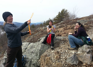
Everyone got a bottle of bubbles in their Easter basket so we had some fun at a couple of stops (to blow bubbles, not to take a break because we're all out of shape - that's our story and we're sticking to it!). Truth be told, we're all about fun and games (and/or snacks) on the trail. Fast hikers we are not.


The trick of hiking in the spring is being flexible. I really wasn't sure if we would be able to summit the North Peak of the mountain. There's no app (that I know of, if you have one let me know!) to check on specific trail conditions for a lightly traveled mountain trail in Maine. I knew there was still plenty of snow visible on the mountain when I saw it from the road so that prompted my caution. And having hiked this mountain previously, I knew there was a steep rocky climb just before the peak. I told the crew I wasn't sure if we'd make it to the top because we were going to err on the side of caution.

Spring time offers up some of the most variable conditions. But lucky for us the mild temps of the day and the recent rain had left little snow on our climb up the mountain.

Getting down was another story. We decided to loop back on another trail. In retrospect (always helpful – not) we should have gone back the way we came. But we had done the loop before and it worked fine for us. Well, with the exception of the bugs being amazingly plentiful on that summer trip. But this was an early spring visit so I guessed that would not be an issue – although we did run across a couple of flying insects. They make those buggers hardy on this trail!

Our trouble with the loop was that it was still snow-covered. Shannon said it best when she used the analogy that this part of the hike was like running on sand. We put a lot of effort into moving without going very far (and slipping on the ice led to cautious stepping). It was good training however for our trip up Mt. Washington – which we spotted (still snow-covered) – for our leg muscles. 


It took us quite a while to hike down the slippery trail. I made a map of our hiking adventure with my EveryTrail app on my Android phone and there was a bit of a snafu with the GPS tracking.  It did a weird zigzag track that ended up calculating more mileage than we actually covered.

I know from our previous hike that this loop is 3.5 miles. But our most recent visit recorded over 10 miles. And I have to say that trek down the mountain, which took us twice as long as the climb up, had us commenting that it had in fact felt like we had gone that far (proving once again that numbers really can lie but suit your needs).

And as you'll note on our map, there aren't too many photos of the trail on the way down. I was working too hard to pull out the camera. 

Burnt Meadow Mountain North Peak Loop


Other photos from the trail.

In honor of the fact that it was Easter.


The bubbles came out of the packs several times. The kids were especially enjoying the bubble blowing antics (via the gusty winds) at the summit.


The last couple of hundred feet of the North Peak trail requires a climb up a rocky face.


It was a view worth the effort (about 1,500 foot elevation gain).

And of course you are never too old to enjoy looking at rocks!


Wednesday, April 3, 2013

Urban trails offer ever-changing landscape

non to "train" for our mountain hiking season (which has started but more on that later). After several weeks of walking the Eastern Prom and Bayside trails we've discovered there is an ever changing guerilla art (a.k.a. graffiti)landscape. Each week there seems to be something new on these trails.

I know this sort of thing should not necessarily be encouraged but now that we've become trail regular we've learned to keep an eye out for what has changed. Sort of the old Highlights children's magazine feature to figure out what's different between two pictures.

I made an interactive map and took photos along the way of the art that struck our fancy this week.

Portland Trails "art" walk


Our weekly visits have confirmed that even though urban trails are less challenging that our mountain hikes, they have something unique to offer with an ever changing - and colorful - landscape.