Monday, August 12, 2013

9 learnings on the hiking trail

My teenagers and I set out to hike Cannon Mountain in Franconia Notch a few weeks ago. Our goal was to stop for lunch at the Lonesome Lake AMC Hut and continue to the summit. However, things didn't work out quite as planned.

Here are 9 things I learned (or more accurately, re-learned) on this hike.

1. Hiking with kids is not always predictable – particularly in the supplies needed-department – even when they are teenagers.

2. Teenagers might fall in mud accidentally but it is just as messy as when they were preschoolers. Only this time mom doesn't have that change of clothes (or socks) she always used to carry for her babies.

3. The Lonesome Lake Hut sell socks!

4. The hut only takes cash (which is, of course, obvious). Thankfully I had exactly the right amount of cash (down to the last four quarters - and why we had (heavy) quarters instead of (light) bills is still a mystery) to buy a pair of clean socks AND the coveted Lonesome Lake Hut patch the girls wanted for their backpacks.

5. Muddy hiking boots – then dipped in a lake to wash off (with feet still in them, which mom did not recommend but was done anyhow) – do not dry in the sun in an hour.

6. Hiking up the trail in squishy, soaking wet hiking boots is not a good time for a hiker.

7. Changing plans and turning around to head home after lunch rather than visit the summit is a good choice for everyone in the hiking party.

8. Each hiker should be responsible to pack a clean pair of socks in their backpack.

9. Everyone should bring their sense of humor to the mountain. I can't remember a time I didn't need to pull that particular item out of the pack at least once during a hike!


 Exhibit 1: Hiker's self-portrait of muddy faux pas. 
...and solution to the problem.

Exhibit 2: Younger sibling trying to contain laughter for having navigated the mud with less mess (and replay the video she took that mom is not allowed to share here of her sibling screaming about falling in the mud).

Exhibit 3: New ($13) socks from the AMC hut.

Exhibit 4: An hour in the sun (without feet in them) does not dry soaked hiking boots but you still need to put them back on anyway. A silly swimmer can make the hiking party smile and therefore all seems OK again.

ON ANOTHER NOTE....
It is possible to be photo bombed by a dragonfly, just in case you were wondering.


Sunday, August 11, 2013

Kid Tracks Column: The view was outstanding, but about those signs


Mount Zircon in Rumford offers a wonderful mountain-top view of the area. What it doesn't offer is the best signage.

The kids and I have spent a lot of time this summer in the White Mountains National Forest (both in Maine and New Hampshire) and have come to expect certain signage, thanks to our familiarity with the national forest. It's not that Mount Zircon's trailhead isn't marked, because it is. It is just not obvious -- and not in the place you might expect.

The old dirt road that serves as the initial start to the trail looks like someone's driveway, complete with house, camper and backyard pool. And once on the trail, the sign turning off the main trail to the summit of the mountain is set back.

On this trail, put your eagle-eyed kids to work looking for the key signage.

While driving, I realized we had passed the trailhead and found a place to turn around. My kids were delighted to find a handwritten sign at the spot I turned around that said, "For Mount Zircon Trail take the road after the bridge." We turned around and found the Tree Farm sign for the Rumford Water District that included a smaller sign just above it for Mount Zircon.

We parked on the small grassy shoulder at the trailhead and passed that house (and pool) as well as a locked red gate to walk up the gravel road that starts the trail. It was a steady but not overly steep climb. About a mile and a half up the old road, we found the remains of the old Zircon Water Bottling Company. The Maine Mountain Guide description we read indicated there was a pipe with running water from the spring. The water looked clean flowing out but the pipe itself seemed slimy and not so clean. In a pinch I would have drank the water but we had plenty in our pack so we took a pass. Still an interesting stop, though.

We hiked up the trail and after a while felt like we'd missed our left-handed turn up to the summit. My mapping program that tracks our progress on the trail indicated we were likely too far into the road and had missed the turn. After a second pass in the area we still didn't see a sign on the trail. A third return pass (there is apparently a reason for the cliche "third time's the charm") was when we finally spotted the white, round "Mount Zircon" trail sign on a tree. It was set back about 50 feet from the trail amid an overgrown area of ferns and greenery. It is a pretty obvious sign once we knew where to look. But when you're used to signage being on a tree or post on the trail itself, we simply weren't looking in the correct place. With all the passing by, we'd hiked about a mile more than we needed to before the real climb to the summit actually began. Yeah, call us knuckleheads if you will but only after you visit this trail in the height of summer's foliage. If you have a GPS application on your phone, input these GPS coordinates (44.4791, -70.5669) before you leave to ensure you don't miss this trail sign.

The summit trail is a narrow path through a more dense forest. Closer to the summit the trail got rocky and the footing a bit trickier because the rocks were slippery with recent rain. It wasn't especially difficult but it did require more purposeful stepping.

We reached the summit to see a fallen-down fire tower and a wonderful mountain-top view. The fire tower carnage was interesting but the kids and I found the wind turbines on Spruce Mountain to be another fascinating feature. We also spotted some of the mountains we've hiked previously and that's always a fun geography lesson for the kids.

The mountain summit at 2,240 feet (with an elevation gain of about 1,600 feet), makes this a "moderately difficult" hike, according to the Maine Mountain Guide. I'd say it's "difficult" for a family of occasional hikers. But if you have kids who like to hike and you've climbed some other mountains this season, you'll enjoy this trek. The climb is worth the effort for the wonderful views.

MOUNT ZIRCON, RUMFORD
Trail head GPS coordinates: 44.5057, -70.564
Trail length: about 5.4 miles round trip
Elevation gain: about 1,600 feet
From the junction of Routes 26 and 232 in Woodstock, take Route 232 for 6.8 miles to Abbotts Mill. Turn right on S. Rumford Road and drive about 6 miles to a gated gravel road on the right. There is a Tree Farm, Rumford Water District sign with a small Mount Zircon sign above it.


Mt Zircon In Rumford


Originally published in the Maine Sunday Telegram Aug. 11, 2013


Friday, August 9, 2013

Mountain top taste-testing makes for fun, motivated climbing

We have spent a lot of time in Evans Notch this spring and summer. Actually we have spent a lot of time in this area over the years. It's about 20 miles north of Fryeburg and has some amazing mountain views.

But in addition to finding some wonderful summits, we've also found a gem of a place to stop to get snacks before we set out on the trail – Quinn's Jockey Cap Country Store (at 116 Bridgton Road on Route 302 in Fryeburg). On first glance it looks like a typical locally-owned convenience store set in any small town in Maine. But this place has bakery-quality desserts and lots of homemade goodness. We've had delicious cakes, cookies, cheesecake and other treats from this place. They also have all sorts of sandwiches and pizza (for breakfast and lunch) and plenty of the typical hiking fare of granola bars, nuts, chips and water. It's a well-stocked place. One thing about it though, it's not particularly inexpensive. But as far as bakery treats and lunch sandwiches go, it's a tasty stop.

The girls and I are not big potato chip eaters but when we pick up a bag, it's typically a salt and vinegar type flavor. At the Jockey Cap Country Store recently we saw several different types of Utz chips and decided it would be fun to buy a variety for a taste test at the summit of Blueberry Mountain (our hike du jour). We also decided to pick up a couple of danishes – raspberry and apple – to round out the sweet versus salty snack experience on the mountain top.

Blueberry Mountain is not the toughest climb we've ever done but in the summer heat, it is a sweaty workout. But it wasn't so bad on this recent trek because we knew we had some fun taste-testing planned once we got to the summit.


The Kettle Classic "Salt and Malt Vinegar" Utz chips won hands-down (or thumbs up if you roll that way) in our book for the tang of the malt vinegar.

We also found some natural goodness to snack on near the summit as well.


Hiking up a mountain can be a serious workout challenge but when you pack the right kind of motivational snacks and approach the day with fun and silliness, everyone in the family has a good time.

It's not always about the view on every trip for us... although we have found that a beautiful setting sure does make everything taste better.


Sunday, July 14, 2013

Kid Tracks column: Evans Notch at its family friendliest

There are a lot of challenging hikes in Evans Notch in the White Mountains National Forest, but there are two hikes in this area that are great for families or those looking for a less challenging trek with great mountain views.

The Roost is a hike that has been on my family's bucket list for years simply because we like the name. But the main reason it took us a while to actually get there is because of how short the hike actually is -- just a half-mile.

I felt if we were going to drive the distance to Evans Notch (about 20 miles north of Fryeburg via a winding road), I wanted to hike a bigger mountain to make the drive worth it. But we finally got there, and my kids found several reasons to like the short adventure.

The trail offers a steady ascent with an elevation gain of about 800 feet, and it took us less than 30 minutes to get to the top. The summit is tree-covered, but a short hike following a marked trail leads to an open ledge with some nice views of the notch.

A feature we liked on this trail was all the animal droppings. We rarely see an animal when we hike, so droppings are a good consolation prize, particularly when there are a variety of shapes and sizes that prompts speculation about what left them. Poop never fails to be a conversation starter for kids of all ages.

The biggest challenge with The Roost hike for us was the bugs. A friend drove us to the trail and I was without my car's usual supply of bug spray. And I forgot to throw a bottle of spray in my backpack. So on a wet muggy day, we were dressed in pants and windbreakers (with hoods). It made for a very hot, buggy hike. Even so, it was a place worth its spot on our bucket list. The hike may have been short, but that offered time to for a quick side trip to shop in North Conway. If there weren't already a dozen other reasons why my kids like Evans Notch, this would be added to my teenagers' list of attractive features.

Unlike The Roost, Blueberry Mountain, also in Evans Notch, was a must-explore from the moment we learned of it. We've hiked the mountain several times over the years. The first time was when the kids were in elementary school. And although longer and more challenging than The Roost -- about 4.6 miles roundtrip -- it's doable for kids with an average fitness level who like to hike.

In the past month I've hiked Blueberry Mountain twice, once with a friend on a new-to-me trail and again with the kids on a loop we usually take to the summit. I now have an informed opinion about which I think is best for families -- the White Cairn Trail to the summit, and then the Overlook Loop to connect to the Stone House Trail to head back down the mountain. The White Cairn trail offers some challenges and a bit of scrambling over rocks, but there are a couple nice views before you get to the summit. This is nice when you need a snack break to catch your breath (and confirm your motivation to get to the top). The Overlook Loop follows the mountain's ridge and offers lots of great lunch spots to take in the surrounding mountains and Shell Pond. The Stone House Trail is an easy descent that has a trail spur to Rattlesnake Pool, a stunning blue/green lagoon-type swimming hole and a favorite spot for us to dip our feet in the water.

The other new-to-me trail to Blueberry's summit is the Bickford Slides Trail to Blueberry Ridge Trail. The Bickford Slides Trail is an easy ascent, but once you make the turn onto the Blueberry Ridge Trail, be prepared to do some serious climbing.

My friend and I stopped several times on the steep, rocky "steps" and had a variety of interesting conversations while taking breaks to catch our breath. Although a more strenuous climb, this trail can offer a loop to summit two additional mountain peaks (Ames and Speckled mountains). It's an all-day adventure to cover the almost 9-mile loop. But when hiking with children, the loop up White Cairn offers an easier half-day hike that I think is more appealing to families hiking with younger kids.

There is an added bonus to hiking Blueberry Mountain this month -- its namesake fruit. The wild blueberry bushes are abundant near the summit, and last week when I was there with the kids, there were already plenty of berries to pick and eat.

 A view from The Roost 

 Rattlesnake Pool on the Stone House Trail on Blueberry Mountain.


THE VIEW FROM HERE
THE ROOST
Trail head GPS coordinates: 44.0593, -70.911
Trail length: 1 mile roundtrip
Elevation gain: about 800 feet
BLUEBERRY MOUNTAIN
White Cairn Trail/Stone House Trail loop
Trail head GPS coordinates: 44.252, -70.9909
Trail length: approximately 4.5 miles roundtrip
Elevation gain: about 1,180 feet
Both trails are in Evans Notch in the Caribou-Speckled Mountain Wilderness area of the White Mountains National Forest, about 20 miles north of Fryeburg on Route 113.

The Roost In Evans Notch


Blueberry Mountain: White Cairn and Stone House trails


Wendy Almeida can be contacted at:
wea@mainetoday.com
Twitter & Instagram: wea1021

Originally published in the Maine Sunday Telegram July 14, 2013.

Monday, June 10, 2013

Hiking: Moose, bear, mosquitoes, oh my!

We decided to hike The Roost in Evan's Notch on the Maine side of the White Mountains National Forest. While driving to the Notch we spotted a moose crossing the Saco River. This was the cause of much excitement for all in our car. Shannon, driving her car on this adventure, pulled over to the side of the road and we all jumped out and ran to the river. The moose had already lumbered across the river by the time we got to the shore so G. was only able to get a far-away photo of the moose. But still, we were jazzed we spotted her on the bridge and it was a testament to our excitement when we returned to the road and the car was still running.

 (You can barely see moose but she's there between the trees.)

As we were driving through Evan's Notch we watched a black bear run across the road about 30 feet in front of us. We all paused for a moment - pretty much in shock - because none of us had every seen a black bear in the wild. Of course I thought the moose would be the highlight and did not have my camera handy for a photo of the bear. You'll just have to take my word for this particular sighting.

As I have talked about in previous posts and print columns, we rarely see any interesting creatures because we talk and laugh and generally create a ruckus in the woods that would scare off even the most bold of creatures. So this is why it was such a remarkable day for us.

We do tend to find a lot of signs of wildlife while hiking. This trip was no different. We found many piles of moose droppings. At the top of The Roost we had a bit of fun pretending to golf with a walking stick.


It was a fun day on the trail.

There was one thing that we encountered that we really could have done without – mosquitoes.

And we forgot something in our packs that I am embarrassed to even admit.

Bug spray!

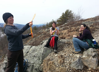
This photo sort of sums up our experience on the trail.


But that shouldn't reflect badly on our final destination. It was a fairly easy hike to a really nice view of the notch.

The Roost In Evan's Notch


Sunday, June 9, 2013

Kid Tracks column: Learning, with plenty of enjoyment

Learning about the outdoors is a work in progress for my family despite the fact we are outside all the time and I've been writing this column for 10 years. But when I'm asked how I learned about trees, birds, the night sky and a whole host of other useful (and maybe not so useful but fascinating) tidbits about the outdoors, I think back to my family's early adventures. When my kids were younger I spent a fair amount of time looking for family-oriented classes. Not classes where I dropped my kids off. No, I'm talking about classes where adults and kids could learn together.

These type of classes are more common than they used to be and I am happy to see this trend has taken off in southern Maine in a variety of venues.

Below is only a short sampling of options based on my family's first-hand experience (both recent and during my kids' younger years).

WOLFE'S NECK WOODS STATE PARK, FREEPORT
My children's first introduction to tree identification was a ranger program at Wolfe's Neck Woods State Park. We went on a tree "scavenger hunt" (now called the "Tree Hunt") with a worksheet and pencil. We returned a short while later with an almost-blank worksheet and spent time chatting up a patient ranger who gave us tips on how to look at trees to figure out what kind they were (it's not just about leaves; bark matters too). We still have that hand-out, now nearly 8 years old, in our family scrapbook.

I contacted Andy Hutchinson, park manager at Wolfe's Neck Woods State Park, about ranger programs this summer. These programs are offered every Saturday and Sunday until June 15; on June 16 the ranger programs are offered daily through July and August at 2 p.m.
Hutchinson said one of the highlights is the "Osprey Watch" scheduled every Tuesday and once every weekend in July and August.

"In July the babies in the nest should be learning to fly and fish. In late August or early September, the baby ospreys should be self-sufficient and ready to migrate to South America on their own, after the parents have already left for South America themselves."

SOUTHWORTH PLANETARIUM AT USM, PORTLAND
I have taken my kids to planetarium shows since they were preschoolers and they have always loved the experience. Despite having seen some of the shows in the dome multiple times, we still seem to learn something new we missed. But mostly my family likes the mythology and other storytelling orientated programs offered there now that they're older.

There are also some changes in store for the Southworth Planetarium this summer. They have given the "Rusty Rocket's Last Blast!" show a makeover. The new computer-animated omni-dome program, which will debut July 15, will offer even veteran planetarium-goers a chance to see and learn about the solar system in a new and entertaining way. Show admission prices for shows range from $5 to $6.50/per person, depending on matinee or evening showtimes.

The planetarium is also teaming up with Portland Trails to offer star watching walks along some of the trails this summer. Check trails.org/programs for more information.

WELLS RESERVE AT LAUDHOLM, WELLS
There is a fun, easy trail system that leads to the beach that we have always enjoyed, particularly in the spring before it actually warms enough to swim (although that doesn't stop my youngest from rolling up her pants and giving her feet a cold water dip). There are also a wide variety of special programs, guided tours and general nature walks that are open to all ages. Some programs have a small fee while others -- like the ones I list below -- are free with the cost of admission ($1/kids; $4/adults).

We attended a bird banding program once and the girls were fascinated with the concept of how that kind of research is conducted.

Suzanne Kahn Eder, education director at Wells Reserve, said a popular family-oriented program at the reserve is the "Life Between the Tides Walk." Families explore the "biodiversity of the intertidal zone at Laudholm Beach." The docent-led walk looks for crabs, sea stars and snails with about a mile of walking. There is another program, "Secrets of the Salt Marsh," that explores the estuary and also focuses learning on marsh habitat.

One of the special programs in July, "Flying Jewels," will explore the wonders of dragonflies and butterflies. The Reserve's natural resource specialist will explain the role the different habitats of the Wells Reserve play in the life cycles of these creature. Nets will also be available to see if participants can catch one for a close look at the fascinating insects. This program will be held July 24 at 1 p.m.
Families can also get a hands-on experience helping native species with the "Monarch Rescue." This citizen science program allows families to join a team of monarch rescuers to find and move monarch eggs and caterpillars to "safe" fields that aren't mowed in the summer. It's Aug. 14 at 9 a.m.

MAINE AUDUBON
GILSLAND FARM, FALMOUTH
There are a variety of family-friendly programs at Maine Audubon centers around the state. A program that has been a highlight for my family has been the "Bird Walk" program at Gilsland Farm in Falmouth. The Thursday morning walks are all about the early bird catching the worm since this program starts at 7 a.m. But as my kids and I can confirm, it was worth the early morning wake-up call. We have learned so much about birds, not only from the Audubon guide leading the walk, but also with the other participants. It's a program geared for novices to expert birders. The times we've attended have been a great opportunity to chat with other birding enthusiasts in a way that has been low key and educational for all ages. The cost of this program is $5/members; $8/nonmembers.

FOR MORE information about family-oriented outdoor programs in southern Maine, try these resources:
Wolfe’s Neck Woods State Park, Freeport
http://ht.ly/lORYA
Southworth Planetarium at USM, Portland
www.usm.maine.edu/planet/events
Wells Reserve at Laudholm, Wells
wellsreserve.org
Maine Audubon
maineaudubon.org/events

Bring a pair of binoculars when you visit Wolfe’s Neck Woods State Park in Freeport. 
The kids will love getting a close look at the osprey nest.  


Wendy Almeida can be contacted at:
wea@mainetoday.com
Twitter & Instagram: wea1021

Originally published in the Maine Sunday Telegram June 9, 2013.

Sunday, May 12, 2013

Kid Tracks column: Keeping fun as the climb's bottom line

The kids and I, along with our friend Shannon, hiked two mountains this past month but we never reached either summit. We are tracking our "numbers" -- elevation gain and mileage -- in our attempt to get into shape for bigger mountains to climb this summer, but we have learned to keep our adventures fun even if it means not getting to the actual summit.

Our first mountain was Mount Megunticook in Camden Hills State Park. The last time we climbed this mountain, it was a 95-degree day. We wanted to tackle this one again when the temperatures were cooler and the backpacks weren't laden with extra water bottles. We had to park outside the entrance gates at this time of year, so that added a bit to our mileage, but it was a lot easier in the cooler temperatures (and lighter packs). According to the AMC Maine Mountain Guide (and a friendly couple we met) the summit is actually in a wooded area with no nice views. The Ocean Lookout offers the best view on the mountain, which is about 135 feet below the actual summit. Since we still managed to hike about a 1,000-foot elevation gain, we felt like we accomplished our goal for the hike and set up our picnic lunch to bask in the springtime sun.

A couple of weeks later we attempted to climb the Red Ridge Trail on the Moat Mountain Trail loop in the White Mountain National Forest in New Hampshire. We have hiked a short part of this trail many times to the waterfalls at Diana's Baths but we'd never gone farther than the falls until this trip.
I saw from trail reports that there wasn't much snow on the Red Ridge Trail but that caution should be used at river crossings at this time of year because of high water.

We found ourselves doing a lot of rock hopping across several small streams (and one big one) on the trail. One crossing offered nothing to walk across above the water line. After some debate we decided to cross the river barefoot. It was not a fast-moving stream nor was it deep, but my 15-year-old found the temperature uncomfortably cold. My daughter said she will never again underestimate the coldness of a mountain stream in spring.

We spent the first couple of miles on easy, fairly level terrain. But when the trail headed upward, it was steady and arduous.

This trail was one of those times that despite examining the trail map in detail, the reality of the elevation gain was more than we expected.

Once we hit the open ledges, we were presented with several maybe-it's-the-summit views as we climbed. But we found that once we got to the top of that ledge, there was another one right behind it.
We never did get to the "unnamed summit" of the Red Ridge Trail (which is at the intersection of Moat Mountain Trail). According to my 15-year-old and Shannon, this trail felt like it was "the mountain that never ends." Words to this effect (or possibly a bit more colorful -- my memory is hazy on this point) were yelled from a spot when yet another view revealed that we still were not at the top.

This is the point when we made the call to stop. We had already completed a 2,000-foot elevation gain (the highest of the season for us so far) and we reasoned that if we had continued, it would have lost its fun. Other than bragging rights, there wasn't any real reason to push ourselves.

So we turned around and expounded on the amazing views of the White Mountains, laughed about our strategies for water crossings and pondered which mountain we might tackle next.

The fact that we were talking about the next mountain adventure confirmed that we'd made the right decision to head home. Because in the end it's more important to me (and the kids) to have fun. Otherwise, why do it?

TWO HIKES TO LIKE

CAMDEN HILLS STATE PARK

WHERE: Camden
TRAIL DIFFICULTY: The climb up Mount Megunticook at 1,385 feet is moderate for teens and difficult for children under 8 years old. The park’s trail map offers brief descriptions of each trail, with a difficulty rating.
RED RIDGE TRAIL

WHERE: White Mountains National Forest, Conway, N.H.
TRAIL DIFFICULTY: This climb is difficult and arduous for adults and teens. I would not recommend for children younger than 8 unless they are experienced mountain hikers. The AMC White Mountain Guide offers a detailed description along with a terrain map.
The reward for a hike up Mount Megunticook in Camden Hills State Park was the 
enjoyment of a marvelous view while getting to bask in the spring sun. 
The Red Ridge Trail on the Moat Mountain Trail loop in the White Mountain National Forest included a great deal of rock hopping across several small streams and one large one.

Camden Hills State Park


Red Ridge Trail on Moat Mountain


Wendy Almeida can be contacted at:
wea@mainetoday.com
Twitter & Instagram: wea1021

Originally published in the Maine Sunday Telegram May 12, 2013.


Monday, April 29, 2013

Agility required to tackle Moat Mountain trail

We went hiking in the White Mountains of New Hampshire the other day. I plan to write a more full account of the trip for my next Kid Tracks column but I know there are some things that will never make it into that 18" column.

For instance, we got off to a slow start due to me not having time to food shop so I had to pick up sandwiches for our mountain top lunch. I lamented the late start but c'est la vie with my schedule lately.

Then a woman at the trailhead locked her car keys in her car and asked us to borrow a phone to call for a rescue. This prompted Shannon and my 15-year-old to discuss yoga moves – and then try them – while we waited for the woman to make her call(s).

 You can see the woman making her call behind Shannon.

We have hiked to Diana's Baths many times and it is still a treat to see the waterfalls in the spring. But truth be told, you have to see – and hear – the falls to really appreciate the splendor.


Roundtrip to Diana's Baths is about a mile on fairly level terrain. It's a nice (young) family-friendly hike.

Despite many visits, this was the first time we'd planned to follow the Red Ridge Trail that snakes up the river to the Moat Mountain loop. I had read in the AMC White Mountain Guide that there would likely be at least one or two tough river crossings that might not be passable in the spring.

It turned out they were not as scary as anticipated but they still required some problem-solving skills and a bit more effort than usual.

The first was the typical walk across on logs. The logs didn't feel all that steady to the adults of the group so Shannon decided to head down the river to a large log she had to straddle and shimmy across. I didn't think the straddle thing looked all that fun so I found another way to cross. We each had our own style and we had a good laugh about it.


Then there was the next big crossing that did not offer stepping stones or logs. After walking up and down the river bank in each direction we determined the only way to get across was to walk through the water. There were no stepping stones above the water and it was only knee-deep. So we pulled off our socks and boots to walk across barefoot. The water was so incredibly cold that my 15-year-old said her feet felt like they were burning from the cold. Not so comfortable but it was a narrow crossing and we all did it without incident.


It's quite challenging to photograph "cold" but trust me, these red feet were dang cold after our river walk-across.

On the return trip across the bare footed crossing, my 15-year-old wore her wool socks to protect her feet from the cold water. It was a good thing I had an extra pair of socks for her to wear on the hike back to the car. I've learned extra socks are a must on mountain trail hiking.

Then there was the third crossing, which was the fastest moving water we encountered. There were stepping stones to jump but it required a not very direct route across with lots of jumping and a good balancing act for each of us.


Other than the river crossings (which really do require some agility so be ready for that if you visit this trail at this time of year), it was a fairly easy hike for the first couple of miles until the terrain started upward. Then the climb was all business and required serious stamina.

If you were out on the trail the day we were, you likely could have heard our exclamations that every time we hit a rock plateau, we saw another one before us.

 You can see the top of this pile and it really does look like the summit. But no, once reached the view would be another just like it.

After four plateaus I decided I was taking a break. Shannon and my 15-year-old climbed one more plateau and I believe they could be heard for miles with their "ugh! There's another one!" exclamations.

I was happy I took a snack break while they made that last discovery.

Despite the fact that we did not make it to the summit of the "unnamed peak" on the Red Ridge Trail portion of the Moat Mountain loop (had we continued after the unnamed peak we would have gone done a steep decline for a bit before climbing up to the summit of Moat Mountain), we felt accomplished. We covered approximately 9 miles total roundtrip and climbed about 1,900 feet. These were the highest numbers of our season so far (we are hoping to tackle Mt. Washington this year so we need to pay attention to our numbers to ensure we can really do that climb).

More important than those numbers however, was the fact that we had some good belly laughs and a memorable hike despite the fact we didn't summit any mountains.

But the consolation was that the view at the elevation we did climb really was awesome.


Here's a peak at our interactive map of the trip. The mileage is off (thanks to a wiggy android GPS app) but the terrain and photo placement is accurate.

Red Ridge Trail on Moat Mountain


My Kid Tracks column runs in print the second Sunday of every month in the Outdoors section of the Telegram. 

Sunday, April 14, 2013

Kid Tracks column: Burnt Meadow Mountain just right for a spring hike

Trying to plan a hike in the spring in Maine, particularly this year, is a real guessing game. Will there be snow? Or mud? Or will we get lucky with some dry conditions? My safest bet has to assume we'll be finding a combination of all three.

Because of the unpredictability of spring hiking conditions, my family tends to stick to trails we have visited previously. This ensures that we are familiar with the basics of the terrain (and knowledge of its trail blazes) to help make a more educated guess about our ability to handle the conditions if the trail is snow-covered.

We decided to visit a mountain trail we are very familiar with -- Burnt Meadow Mountain in Brownfield. Last summer we hiked to the summit for the first time (although we'd visited many times before summitting). The hike we took in July was hot and amazingly plentiful in the bug department. We decided after that hike it would be a good idea to visit again during the off-bug season.

On our drive to the mountain I told my passengers (my teenagers as well as our friend Shannon) that we might not make it to the summit of the mountain. We were going to play it safe because there was a steep, rocky climb during the last part of the North Peak Trail.

Luckily for us, the mild temperatures of the day and the recent rain had left little snow on our climb up the mountain. But getting down was another story because we decided to loop back down on the Twin Brook (yellow blaze) Trail to the Burnt Meadow (blue blaze) Trail. Our trouble with Twin Brook Trail was that it was still snow-covered. Shannon said it best when she used the analogy that this part of the hike was like running on sand.

We put a lot of effort into moving without getting very far with all the cautious stepping we did. I also feel that going down a mountain trail is actually harder than climbing up and this particular day confirmed that sentiment.

It was, however, good training for our leg muscles for our trip to Mt. Washington -- which we spotted (still heavily snow-covered) from this mountain -- and which we plan to tackle later this year.
I made a map of our hiking adventure with my EveryTrail app on my Android phone and there was a bit of a snafu with the GPS tracking. It did a weird zigzag track that ended up calculating more mileage than we actually covered.

I knew from our previous hike that this loop is 3.5 miles with an elevation gain of about 1,200 feet. But our most recent visit recorded over 10 miles. And I have to say that trek down the mountain, which took us twice as long as the climb up, had us commenting that it had in fact felt like we had gone that far (proving once again that numbers really can lie to suit your needs when you want them to).

With this first mountain hike of the spring under our belts, we are researching our next trek. The trick is deciding where to go based on conditions we can handle without any specialized gear. A coastal mountain hike in Camden has made the short list for our next adventure in hopes of a less snow-covered experience.

No matter which mountain you decide to hike this spring, be sure to talk to the kids ahead of time that plans may need to be changed on a moment's notice based on the trail conditions you find along the way.

Even with teenagers, I find a chat ahead of time saves a lot of "debate" about mom's decisions on the trail.

Despite the snow conditions and the early April date, we did run across several flying insects on the loop back down the trail. The bugs on this trail are amazingly hardy.
 
Hiking at this time of year can be a mixed blessing – it’s great to get out ahead of the bugs, 
but the trails often can be a challenging mix of mud, snow and dry terrain. 

The last part of the trail before the summit of North Peak Trail is a steep climb, 
but it was thankfully free of snow and ice on this day.

Burnt Meadow Mountain North Peak Loop


Staff Writer Wendy Almeida can be contacted at:
wea@mainetoday.com
Twitter & Instagram: wea1021

Originally published in the Maine Sunday Telegram April 14, 2013.
Friday, April 12, 2013

A lesson in Geocaching trackables

When doing some maintenance on one of our geocaches the kids ran across a "coin." We originally thought it was a Travel Bug, an item that travels from one geocache to another that is tracked online, but we were mistaken. It turns out there are all sorts of "trackables" to be found in a geocache. The one we found was actually a signature item.

The "Kayaking Loon" Path Tag we found was actually a signature item this particular geocacher leaves in the geocaches s/he finds.

Confused about the trackables in the geocaching game? I have a basic working knowledge of them but don't know the details of every kind, which was obvious upon me mistakenly identifying a Path Tag signature item for a Travel Bug.

When a geocacher finds a Travel Bug in a geocache they are supposed to look for the unique serial number on its tag and log it into the geocaching website's special Travel Bug page. This alerts the owner their Travel Bug was found. It is then the geocacher's job (because they picked up the Travel Bug) to move the Bug along to a new geocache.

A few years ago my kids' 4-H club launched a Travel Bug as part of a national 4-H program called CYFERnet and spent nearly a year tracking their little 4-H keychain (with special ID tag) online. Their Travel Bug connected with some wonderful geocachers and that little Bug made it to four different continents and traveled 21,985 miles that year. They won the CYFERnet contest and the kids could not have been happier.

 The 4-H Walker Travel Bug was simply a 4-H keychain with a special ID tag that was registered on Geocaching.com as a Travel Bug.

 
The kids' travel bug traveled 35,873.7 miles before it was marked missing. The bug's information page automatically plots all the locations it was found on this handy-dandy (and quite fascinating) map.

We have had other travel bugs that have jumped states, countries and continents but none traveled as far as that 4-H one did. And these days we haven't heard a peep from the location of most of them. But that's how things happen, eventually.

So when the kids found a coin with a serial number on it, of course we thought it was a Travel Bug and wanted to do the responsible thing and move it along to another geocache. But when I noticed the website to log the find of the traveler – www.pathtags.com – I realized it was something different.

Turns out Path Tags are signature items for geocachers. They can order 100 coins (minimum order) they design themselves and drop them in geocaches, trade them or do whatever they like. It's their signature to show they've found a geocache. Over the years the kids and I have seen a wide variety of signature items – from wooden coins to small knit bags (sized to hold a GPS unit) to a little stretchy frog you get in a bag of a dozen from the dollar store. Some geocachers have a favorite item and there have been several times when we've found the same item in multiple geocaches. Even though it might sound a bit overly serious, it can be fun for the person who leaves the signature item and for the people who find them.

It turns out the Path Tag we picked up does not need to be passed on to a new geocache. It's ours to keep and collect with others. I'm not sure how many people drop these not-so-cheap signature items in geocaches around Maine but they are really nice (and clever) and we are now on the lookout for them.

There are so many fun ways to enjoy geocaching even when you don't have time to get out and hike to find one.

Friday, April 5, 2013

Hiking Burnt Meadow Mountain, bubbles included

We took our first big mountain hike of 2013 with a trek up  the North Peak trail of Burnt Meadow Mountain in Brownfield.

Everyone got a bottle of bubbles in their Easter basket so we had some fun at a couple of stops (to blow bubbles, not to take a break because we're all out of shape - that's our story and we're sticking to it!). Truth be told, we're all about fun and games (and/or snacks) on the trail. Fast hikers we are not.


The trick of hiking in the spring is being flexible. I really wasn't sure if we would be able to summit the North Peak of the mountain. There's no app (that I know of, if you have one let me know!) to check on specific trail conditions for a lightly traveled mountain trail in Maine. I knew there was still plenty of snow visible on the mountain when I saw it from the road so that prompted my caution. And having hiked this mountain previously, I knew there was a steep rocky climb just before the peak. I told the crew I wasn't sure if we'd make it to the top because we were going to err on the side of caution.

Spring time offers up some of the most variable conditions. But lucky for us the mild temps of the day and the recent rain had left little snow on our climb up the mountain.

Getting down was another story. We decided to loop back on another trail. In retrospect (always helpful – not) we should have gone back the way we came. But we had done the loop before and it worked fine for us. Well, with the exception of the bugs being amazingly plentiful on that summer trip. But this was an early spring visit so I guessed that would not be an issue – although we did run across a couple of flying insects. They make those buggers hardy on this trail!

Our trouble with the loop was that it was still snow-covered. Shannon said it best when she used the analogy that this part of the hike was like running on sand. We put a lot of effort into moving without going very far (and slipping on the ice led to cautious stepping). It was good training however for our trip up Mt. Washington – which we spotted (still snow-covered) – for our leg muscles. 


It took us quite a while to hike down the slippery trail. I made a map of our hiking adventure with my EveryTrail app on my Android phone and there was a bit of a snafu with the GPS tracking.  It did a weird zigzag track that ended up calculating more mileage than we actually covered.

I know from our previous hike that this loop is 3.5 miles. But our most recent visit recorded over 10 miles. And I have to say that trek down the mountain, which took us twice as long as the climb up, had us commenting that it had in fact felt like we had gone that far (proving once again that numbers really can lie but suit your needs).

And as you'll note on our map, there aren't too many photos of the trail on the way down. I was working too hard to pull out the camera. 

Burnt Meadow Mountain North Peak Loop


Other photos from the trail.

In honor of the fact that it was Easter.


The bubbles came out of the packs several times. The kids were especially enjoying the bubble blowing antics (via the gusty winds) at the summit.


The last couple of hundred feet of the North Peak trail requires a climb up a rocky face.


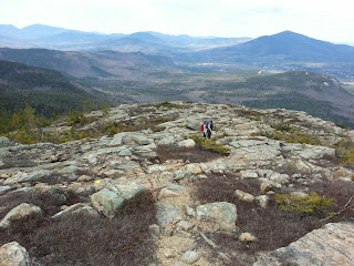
It was a view worth the effort (about 1,500 foot elevation gain).

And of course you are never too old to enjoy looking at rocks!


Wednesday, April 3, 2013

Urban trails offer ever-changing landscape

non to "train" for our mountain hiking season (which has started but more on that later). After several weeks of walking the Eastern Prom and Bayside trails we've discovered there is an ever changing guerilla art (a.k.a. graffiti)landscape. Each week there seems to be something new on these trails.

I know this sort of thing should not necessarily be encouraged but now that we've become trail regular we've learned to keep an eye out for what has changed. Sort of the old Highlights children's magazine feature to figure out what's different between two pictures.

I made an interactive map and took photos along the way of the art that struck our fancy this week.

Portland Trails "art" walk


Our weekly visits have confirmed that even though urban trails are less challenging that our mountain hikes, they have something unique to offer with an ever changing - and colorful - landscape.